- English
- Magyar
- Русский
- Українська
Languages:
This site is created using Wikimapia data. Wikimapia is an open-content collaborative map project contributed by volunteers around the world. It contains information about 32494086 places and counting.
Learn more about Wikimapia and cityguides.
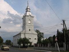
Pyiterfolvo
The village of Pyjterfolvo (formerly Petrovo)
Pyiterfolvo on the map.